Celtic Britain

Short Tours

These sights are all within a shorter distance from Glastonbury and can be reached on halfday tours or shorter.

If you are interested in other sites, which are not mentioned here, please contact me with your request, and it may well be arranged.

Glastonbury Zodiac

Glastonbury Zodiac is a collection of special landscape features, natural and man-made, resembling the constellations of the Zodiac itself.

This landscape has many layers, and you can chose, whether to enjoy the nature, walk in the footsteps of Joseph of Arimathaea, recollect the stories of the Round Table or to find the special spot to connect to your personal horoscope, or all of these. 

The Glastonbury Zodiac, part of the sacred landscape in the West Country, is a ring of figures shaped by hills and valleys, outlined by rivers, boundaries and roads. Suggestively dated to 2000 BC, the figures were rediscovered in 1925 by the sculptor Katherine Maltwood,, while working on illustrations for ‘The High History of the Holy Grail’.

Here we have a circle of figures, 11 miles across, shaped by nature and the help of man mirroring the sky above; the stars and the movements of the Sun, Moon and planets through the signs of the Zodiac are all drawn in to the landscape.

Here and in the surrounding areas we find a multitude of ancient sacred sites resonating with the Goddess of the Land, Bridie, Morgan, Ana, and Ceridwen. Healing springs and wells, underground caves, earthworks, and beacon hilltops all form a network of experiences for those who go on a quest. Here people have trod on pilgrimage since the dawn of history; Sumarians, Jesus, Joseph of Arimathea, early Arabians; they all are said to have come.

Here was the place chosen for the first Christian church on English soil. The names of St. Dunstan and St. Bridgit are closely linked with this area.

Here we find the legends of King Arthur and his knights made flesh, The Round Table inscribed in the landscape itself. The ladies of the legends being reflections of ancient Celtic Goddesses.

A treasury of wisdom is available for those choosing to go on a quest for the message hidden in the hills and vales; to find the Grail – eventually to find ones self.

The idea, that part of the stellar constellations, zodiac and the paths of Sun, Moon and planets are reflected in natural landscape features, enhanced by the building of earthworks and temples, is a concept widely explored in the later years in some studies of the pyramids of Gizah, Mayan ruins, Ankor Wat etc.. However this was well-known to the ‘ancient ones’ and several ‘indigenous’ people of today. I offer to guide you through the various sights of this landscape temple and to help you become aware  of the forces and energies present and the potential for self-discovery through the use of your own personal horoscope, should you so wish.

I can bring you on a short tour choosing just a few of the sights and signs, maybe focusing on places in your own horoscope or places of specific interest to you. Or we can spend a day doing the whole round.

See more on:

https://en.wikipedia.org/wiki/Katharine_Emma_Maltwood   Katherine Maltwood

https://www.goodreads.com/book/show/1386788.Encyclopedia_of_Occultism_and_Parapsychology   Occultism & Parapsychology Encyclopedia   

Glastonbury

Glastonbury is a place, where pilgrims have trod since ancient times, and still they come.

Old Age – New Age, the times where Jesus walked this land, Age of Legends and chivalry, Bronze and Iron Age remains, alternative mecca today, where you can find just about any therapy or technique for prediction.

Major ley-lines meet here forming vortex’s of energy.

Glastonbury was a centre of pilgrimage long before tourism and New Age were invented. Many ancient tracks and pilgrim routes come this way. Legend has it, that Jesus himself came, as a young boy, with Joseph his uncle, who was a tin trader. The connections with Joseph of Arimathaea are more persistent, as he is said to have come here after the last supper with two cruets containing Jesu blood and sweat, followed by 12 disciples, and together they founded the first church on English soil, in deed on Western soil, when they build a small round wattle church in what is now the Abbey Grounds.

The present High Street is a newer road, the old one being Silver Street running along the Abbey Grounds, but now cut off by newer buildings.

The Tribunal houses the Lake Village museum with finds from the excavations by Arthur Bulleid around the turn of last century, as well as the Tourist Information point. Entrance fee.

The George and Pilgrim hotel is of very old origin, it was visited by the Abbots from across the road.

The Rural Life Museum is situated in the old Abbey Barn.

The perilous bridge has from medieval times led travelers across the river Brue from Street.

There are many interesting shops in Glastonbury, many crystals and special herbs, but also wands and special books can be found. Alternative Therapies are plentiful, you can find most things here, and readers of various kinds, tarot, aura and astrologers.

See more on:

http://en.wikipedia.org/wiki/Glastonbury                Info on Glastonbury on Wikipedia

https://www.crystalinks.com/glastonburytor.html   The Abbey, The holy Grail and King Arthur

Gog and Magog, Ancient oaks

Ancient oaks, last of an avenue leading up on the Tor, now sadly dying.

Other oaks from that avenue was dated to be about 2000 years old. Tree worship was an important part of early Celtic religion.

The oak was one of the most sacred trees to the Druids, who spoke of the Oak king and the Ivy king, each reigning for half a year, then dying.

Glastonbury Tor

Beacon Hill with historical and legendary significance, sacred to many, brilliant view from there, whatever your persuasion, over the moors and levels, once covered in water, you can still get that feeling sometimes – unless you are in the middle of a cloud called the Somerset Mist.


Glastonbury Tor is a 521 foot (158 meter) high conical hill, visible at a great distance across the Somerset Levels, a landmark for centuries and millennia, recognized today by the many due to the church tower still standing on the top, while the rest of St. Michael’s Church has crumbled to the ground. Likewise from the top you can see very far to the Mendip in the north, to Cadbury/Camelot in the south, and to Brent Knoll in the west, and on a really clear day all the way to south Wales. But on different days, you will find yourself in the middle of a misty cloud and think yourself to be alone in the world, or you might experience one of the few times where the levels are flooded again, and find the sun glinting in all the rhymes and the clouds mirrored in the pools of water, this is when you can feel for your self, how things would have been back then, when Avalon was an island, this is the real Isle of Glass.

Today seen as the male aspect, Chalice Hill with its blood-spring being the female, it is probable, that in its origin it would have been seen as female as well, the Goddess being celebrated on all hills of the land. It is suggested, there is a maze on its slopes, which can be walked on a dry’ish day with good firm boots. This may possibly have been a spiral path leading up to the top, used by Druids to form a procession snakelike to the top with torches shining in the dark nights. Dragons or serpent stories are told here. As are stories of the fairy king, Gwyn Ap Nudd.

In early Christian times, hermits were living in cells on the Tor.

The first church stems back to late 12th century and dedicated to St. Michael, which was often the case when building churches on ancient sacred sites. This church fell in 1275, when an earthquake rocked the Tor. A new church was build and the remaining tower is from the 14th century. Two relief’s on the tower, one showing St. Michael holding the scales, and one showing St. Bridget milking a cow.

Halfway down on the steep slopes under a hawthorn is hiding the Egg Stone, a stone special to this area. Further down is a small grove with magical trees.

There are many stories about tunnels and caves under the Tor, but they appear to have been blocked or collapsed.

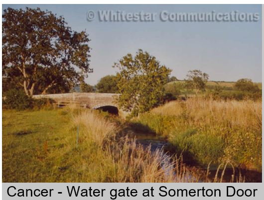
The Michael Line runs over the Tor, and there is a strong vortex on the top. An other major ley-line, straight east-west, goes to Stonehenge in the east and the Prescelly mountains in Wales.

See more on:

<a href=”http://en.wikipedia.org/wiki/Glastonbury_Tor” target=”_blank”>Info from Wikipedia</a>

<a href=”http://www.themodernantiquarian.com/site/39″ target=”_blank”>Info on TheModernAntiquarian</a>

<a href=”http://www.earlybritishkingdoms.com/archaeology/glastor.html”

<a href=”http://gothicimage.co.uk/books/tormaze1.html” target=”_blank”>The Glastonbury Tor

<a href=”http://england-travel.suite101.com/article.cfm/glastonbury_tor” target=”_blank”>The Glastonbury Tor and the legnd of King Arthur</a>


White Spring

Less known than its partner across the road, Charlice Wells, but just as important, as the Red and White are the fundamental colors of the English land.

Housed in a building now made into a shrine for various aspects of the Goddess.

The water flowing from here is rich in calcium and other minerals.

From under the Tor springs the White Spring, which used to form a beauty spot of cascading waters over limestone deposits. Unfortunately somebody got the brilliant idea of building a water reservoir right on it, piping the water for the towns reserves, only to find out a few years after, that the lime-scale totally blocked up the pipes, and it was abandoned. It was used as a folly for many years and had a chequered history of cafés and shops, but is now in the hands of more considerate people, who have turned the different rooms into shrines to different aspects of the goddess or the Mary.

To meet the waters inside is the strongest and most beautiful experience, but if unavailable, the waters can always be collected from a small pipe outside in the corner of the building. Before the existence of the reservoir, the two waters, the Red and the White, would have met out there in Wellhouse Lane and flowed down through town together. The White is considered the male aspect of the two waters, flowing from the masculine hill of the Tor, but due to its high contents of Calcium it is advised for women to drink it in their wise woman years.

Access is irregular, but it is often to be found open around the cross-quarter days.

See more on:

http://flickr.com/photos/jackiesjottings/sets/72157607992027124/    White Spring on Flickr

Chalice Wells

Most renown of healing wells, people have come here for millennia to get healed for physical as well as emotional and mental troubles.

Meeting place of the Mary and Michael lines. The water is rich in iron and other minerals. Set in lovely gardens.

Chalice Well was a place of healing and sacred ritual long before Joseph of Arimathaea came along, the natural properties of the waters would not have gone unnoticed by the early settlers, and it would have been a major goddess site. However when Joseph reputedly came, he is said to have hidden the cup with Jesu blood in the well, and since then it sprang red with his blood. The redness is actually iron deposits, which makes it very good for women to drink, but many other minerals can be measured in the waters.

This water always flows and always has the same temperature, because it comes from layers deep under the Mendip Hills. You can enjoy this water for yourself from the Lion Head fountain, or if the garden is closed, it always runs from a tap outside in Wellhouse Lane, right across from the White Spring. So you can mix the two, should you wish.

The healing energy is felt strongest at the Wellhead, where the waters first come out of the earth. However this was not always a well, but previously a spring flowing naturally down through the valley. But a landslide covered it up, and it was necessary to dig a well to reach the clear waters again.

Both the Mary and the Michael Line runs through this garden, and they cross in King Arthur’s Court, where also the water from the White Spring would have entered.

There is an interesting shop inside. Entrance fee.

See more on:

http://www.chalicewell.org.uk/   The Chalice Wells Trust

http://www.mystical-www.co.uk/glastonbury/chalice.htm  Mystical World Wide Web

Glastonbury Abbey Grounds and ruins

Holiest of Holy as far as Christians are concerned, the earliest church  on English soil, reputedly founded by Joseph of Arimathaea when arriving with his 12 disciples carrying the blood and the sweat of Jesus.  Well explained ruins, the Lady Chapel and St. Joseph’s Well, extensive parkland.

Holiest of Holy as far as Christians are concerned, the earliest church  on English soil, reputedly founded by Joseph of Arimathaea when arriving with his 12 disciples carrying the blood and the sweat of Jesus.  Well explained ruins, the Lady Chapel and St. Joseph’s Well, extensive parkland.

When Joseph of Arimathea came to Glastonbury with the blood and the sweat of Jesus, he and his 12 disciples built a settlement of 12 little round huts and a round wattle church in the centre, this is where later the Mary Chapel was built.

St. Mary’s Chapel dates from 1186 and is the best preserved of the ruins of the great Abbey. In its crypt you can see the St. Joseph Well, also reputed to have healing powers, but it is now closed off for safety reasons. Services are still held in the crypt of this chapel.

Glastonbury Cathedral was one of the largest in the land, which is understandable, when it was built to commemorate the arrival of Christianity in England. The ruins are well explained.

One gem of a building left intact is the Abbot’s Kitchen, which has the most exquisite acoustics.

Saint Patrick’s Chapel is an almshouse chapel still in use today.

The grounds are laid out with an old apple orchard, the Abbots Fish Pond and rare trees.

Small museum entrance with finds form the old abbey.

The great ley-lines, the Mary and the Michael both wind their way through the Abbey Grounds, and cross on the way.

Entrance fee.

Wearyall Hill and the Holy Thorn

Natural ridge, where Joseph of Arimathea first entered Avalon. He planted his staff, which sprang leaves and flowers.

Beckery Ridge, historical entrance to Avalon, as one of the sweat tracks across the moors entered here and the old pilgrim trail came over this hill. Chapel remains underground and the finding place of the Blue Bowl.

Wearyall Hill has shape like a fish, and sticking out of the waters of the levels, it might have resembled a salmon coming up for feeding of the hazels to the ancients. There are said to be remains of an ancient wharf on its slopes.

This long hill is most famous for its Holy Thorn, though sadly the original was cut down by a farmer, annoyed with all the people walking onto his land. When Joseph of Arimataea with his disciples came across to Avalon, he came first to Wearyall Hill, where he planted his staff in the ground, and it sprang leaves and flowers.

The descendants of this tree, a species normally found in the Middle East, still flowers throughout Glastonbury every Christmas and Easter

See more on:

<a href=”http://www.welcometoglastonbury.co.uk/2008/01/wearyall-hill.html” target=”_blank”>Glastonbury Holy Thorn</a>

<a href=”http://www.megalithic.co.uk/article.php?sid=2146412156″ target=”_blank”>Wearyall Hill under threat</a>

Bride's Mound

Beckery Ridge, historical entrance to Avalon, as one of the sweat tracks across the moors entered here and the old pilgrim trail came over this hill. Chapel remains underground and the finding place of the Blue Bowl.

The Beckery Ridge stretches from the river Brue up to what was called the Castle Mound, now disappeared under a modern timber-yard.

The summit is popularly called Bride’s Mound, as it is believed, this place was originally dedicated to the ancient goddess Bridie, and priestesses tended to the pilgrims entering the Sacred Isle. Later a small chapel was built here, first a wooden chapel, then two fazes of a stone structure is known. This was originally dedicated to Mary Magdalene, but when St. Bridgit (or one of her sisters) visited, she stayed there, hence it became dedicated to her. There is a historical connection with Ireland, as it is known, that Irish monks visited the area and stayed, it was also called Little Ireland.

An ancient pilgrim track went along the back of the hill from a crossing of the river Brue.

Here is also the place of the finding of the Blue Bowl, connected to Wellesley Tudor Pole, now in the caretaking of Chalice Well.

You can read more details about this interesting area on the homepage:

<a href=http://www.friendsofbridesmound.com/ target=_blank>www.friendsofbridesmound.com</a>

Lake Village sites

The Moors of Somerset were populated with people living in villages built on stilts in the peat and moving around on track-ways through the wet-lands as well as boats.

Some sights are still known, and Peat Moors Centre offers reconstruction of these buildings and lifestyle.

Glastonbury / Godney Lake Village was discovered and excavated in the 1890’s by Arthur Bulleid.

Meare Lake Village was found a few years later Both can be seen only as some humps and bumps in a field, and they are dated to about 400 B.C.

Finds from these sights are on display in the Tribunal in Glastonbury High Street.

The levels were navigated in boats, but remarkably the marshland was also crossed on foot on the many tracks laid down between the reeds, dated between 3500 – 500 B.C., most famous of these being the Abbots Way and the Sweet Track. The excavated remains of these can be seen in the museum in Taunton.

The Peat Moors Centre between Westhay and Shapwick has reconstructed several roundhouses of the periods and the Sweet Track. They are situated on the edge of the restored peat land of the Avalon Marshes, Shapwick Heath, Ham Wall and Westhay Nature Reserve. It is open from April till October and offers several events and demonstrations throughout the year. Entrance fee.

See more on:

<a href=”http://en.wikipedia.org/wiki/Glastonbury_Lake_Village” target=”_blank”>Info from Wikipedia</a>

<a href=”http://www.isleofavalon.co.uk/sacredsites/godney.html” target=”_blank”>Sacred sites</a>

Wells

England’s smallest city with a huge cathedral, Bishop’s Palace and the bubbling waters of St. Andrew’s Well, which gave the place its name.

Cheddar Gorge

A rocky gorge shaped by the running waters.

In caves in the area were found human remains and they are now open to visitors.


Stanton Drew

Three large stone-circles with more sheep than humans between them.

In the garden of the pub stands three large stones from a dolmen.


Stoney Littleton Long Barrow

Big long barrow aligned with the winter solstice sunrise, when you can observe the sunrays hit the wall of the inner chamber.

Woodhenge and Durrington Walls

Woodhenge was the predecessor for Stonehenge, the post-holes now marked by concrete blocks.

Durrington Walls is where the builders of Stonehenge lived, a huge fortified village, currently undergoing a ten year plan of excavation, which is exposing many interesting finds including a second avenue out to the river.

Stonehenge

The most famous of all stone circles, also one of the latest in its finished state, with its huge Sarsen boulders creating and enclosed circle and the horseshoe inside, and the Blue stones from Wales as inner rings.

This masterpiece is aligned both to summer-solstice sunrise and a number of other cosmic events. Set in a landscape rich in barrows and dolmens, and the Avenue running down to the river.

Old Sarum

Iron age hill-fort, the predecessor of Salisbury.

The area is well excavated and presented to the public.


Cadbury Castle

Iron age hill-fort within sight of Glastonbury Tor, withstood the Romans for long, reputedly the legendary Camelot.

Ham Hill

Hill-fort.

A new stone circle was created on top with interesting effect to the energies of the sight.

Healing Wells and Springs

Of these there are many throughout the land, and wherever you choose to go for a tour, if you wish, we can incorporate one or more in the program.

Glastonbury has its fair share, with Chalice Well, White Spring, St. Joseph’s Well and several more obscure to chose from.

Long tours

These sights are all further away from Glastonbury and will require a full day for a visit.

If you are interested in other sites, which are not mentioned here, please contact me with your request, and it may well be arranged.

Avebury

The largest stone-circle in the world, encompassing two inner circles with the Cove and an obelisk, set in a landscape very rich in standing stones and megalithic sites, the Avenue to the Sanctuary and numerous barrows and dolmens, within sight of the ancient Ridgeway. Dating back 4000 years.

Here you can walk and touch the Stones and explore the different settings. The Alexander Keiller Museum and the Great Barn has an entrance fee.

Silbury Hill

The largest manmade hill in Europe which original purpose is still disputed.

It was covered in shining limestone, and often surrounded by waters from the Kennet river.

No access to go onto the hill

West Kennet Long Barrow

Impressive Long Barrow set high on the ridge, presumably the first ceremonial structure in the Avebury complex.

Access to the inner chambers.

Aligned to the sunrise at the Equinox’es, but huge stones were set to block the entrance at the end of its use

Swallowhead Springs and the Kennet river

Delightful spot, the birth of a sacred river, the Kennet River, this spring is sacred and has healing properties at its source.

In later years it has been dry for periods.

Uffington White Horse

Britain’s oldest chalk horse figure and maybe the most elegant, high on the hillside overlooking the land; the best view has to be from above.

Dragon Hill just below has a barren chalky surface, where reputedly St. George slew  the Dragon, thus poisoned the ground with its blood.

Uffington Castle and Ridgeway

Hill-fort overlooking a wide landscape, just above the White Horse, possibly late Bronze Age, about 800 B.C.

The Ridgeway is an ancient track-way leading across England from The Wash to Axmouth in Devon; passing many prehistoric sacred sites, from here it runs down past Avebury.         

Wayland Smithy (long barrow)

A big long-barrow with access to the interior, Neolithic, dated to about 3500 B.C. Close to the prehistoric Ridgeway.

Rollright Stones

The Kings Men stone circle is 38 Druids Cubit across also called megalithic yards, consisting of now 77 very weathered stones, dated to 2500-2000 B.C.

The Whispering Knights are the remnants of a dolmen or long barrow from app. 3000 B.C.

A monolith across the road, The King Stone, standing lonesome and twisted, its origin is uncertain.

Small entrance fee.

Cerne Giant

Unique chalk figure carved into the chalk bedrock of the hillside, the largest in Britain, 180 feet high. Reputedly a fertility sight.

The village has a ruined abbey and a holy well.

Dorchester and Maiden Castle

Maumbury Rings started life as a Neolithic henge, became a Roman Amphitheatre and last  as artillery-fort in the 1600’s. The earthwork is clearly visible, but no stones.

Maiden Castle is the largest Iron-age hill-fort in Europe, though the first settlements date back to about 3000 B.C. Just to the west of Dorchester.

Dorset Stones and sacred sites

Nine Stones just outside Winterbourne Abbas is a delightful little stone circle.

The Grey Mare and her colts.

Dartmoor

This vast moor-land is home to a number of stone circles and the more unusual stone rows, which you will find while trekking across windswept Tors and swampy valleys.

You can also find old settlements, clapper bridges, mill-sites and secret groves.

Ponies are often visiting the roadside.


Bodmin Moor

The most brooding of the moors, unless you chose a sunny day. A rugged landscape of granite tors and huge windswept expanses, much covered in heather.

Rich in bronze age sites, settlements, cairns, stone circles. The Hurlers, the peculiar Cheesewring, Dozmary Pool.

Tintagel, the legendary birthplace of King Arthur

Dramatic settlement on a rocky outcrop surrounded by the sea, the legendary birthplace of King Arthur. 

The ruins visible today are of a Norman castle. Entrance fee.

Merlin’s Cave underneath is accessible only in the right tides and weather conditions.

The village also has a King Arthur’s Hall, decked up to the theme.

Boscastle, Rocky Valley and Nectan’s Glen

Boscastle is a pretty village at the bottom of the valley, most famous for its Witchcraft Museum.

Entrance fee.

Rocky Valley is a gorge formed by a river, where is carved two small labyrinth petroglyphs on the rock-face, the only found in England.

St. Nectan’s Glen is a magical pool shaped by a waterfall, the place has a fairy feeling to it.

Entrance fee

Exmoor

Large moor-land inhabited by sheep and ponies and much wildlife.

There are many megaliths strewn around the vast landscape, some set in circles or rows.


Bridie / St Bridget trail

The goddess Bridie has many sites dedicated to her throughout the land, in the West Country she had Bride’s Mound and sites nearer the coast.

In Dorset two rivers run out into the sea not far from each other, the Bride and the Brit, both rising from the slopes higher up, where the birthplace of these streams can be located.

Healing Wells and Springs

Of these there are many throughout the land, and wherever you choose to go for a tour, if you wish, we can incorporate one or more in the program.

The further out into Cornwall you get, the more are the traditions around honoring the healing wells still alive.